CA Snow Surveys
The April 1st snow surveys were completed and the Tuolumne and Merced River drainages are both over 240% of precipitation which means lots of water this summer.
How are these numbers determined, who does it, and why? The answer, California Cooperative Snow Surveys and the surveyors who collect data from 265 snow courses throughout the state of California.
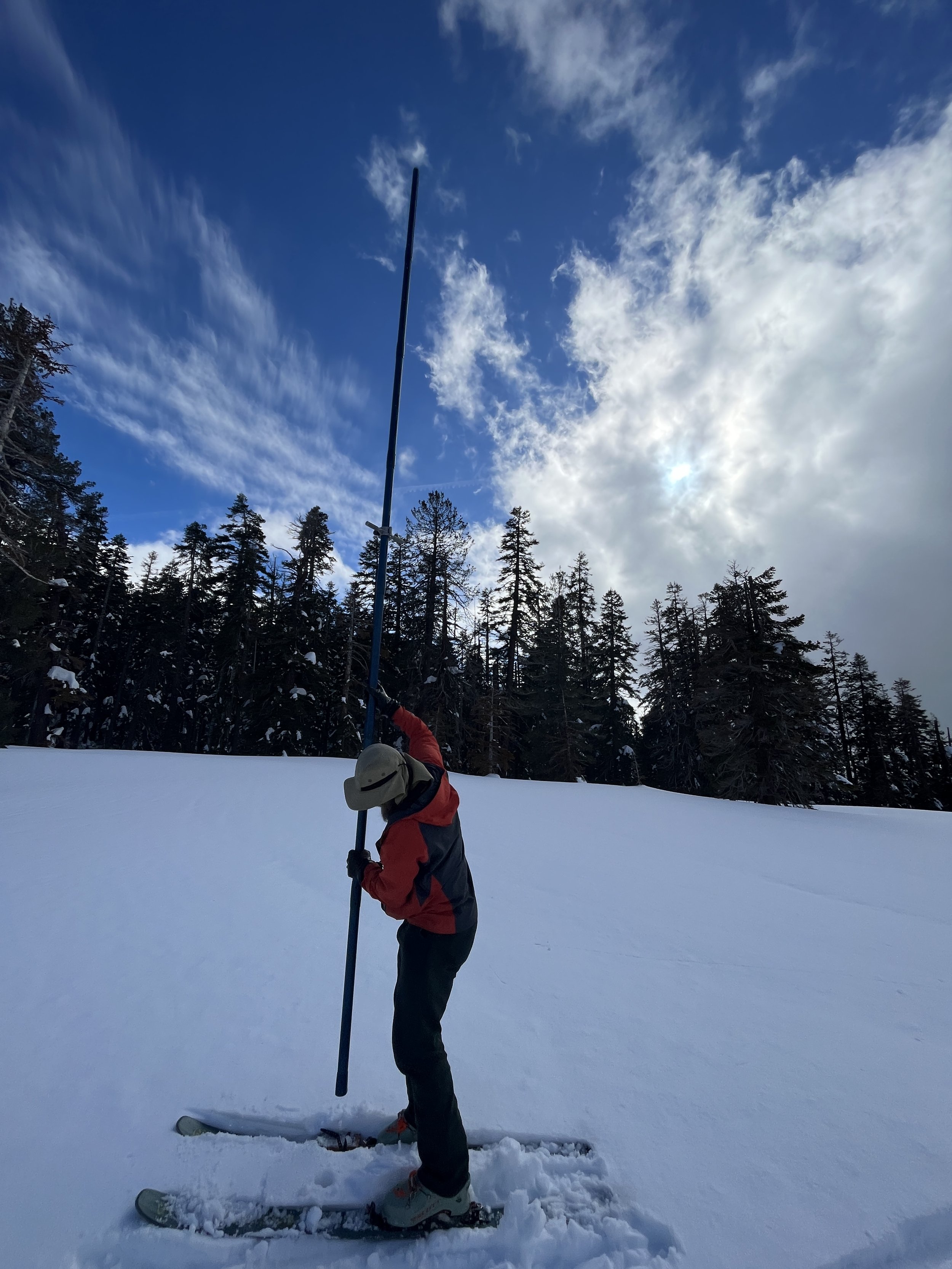
Ranger Chuck-The Tube Master
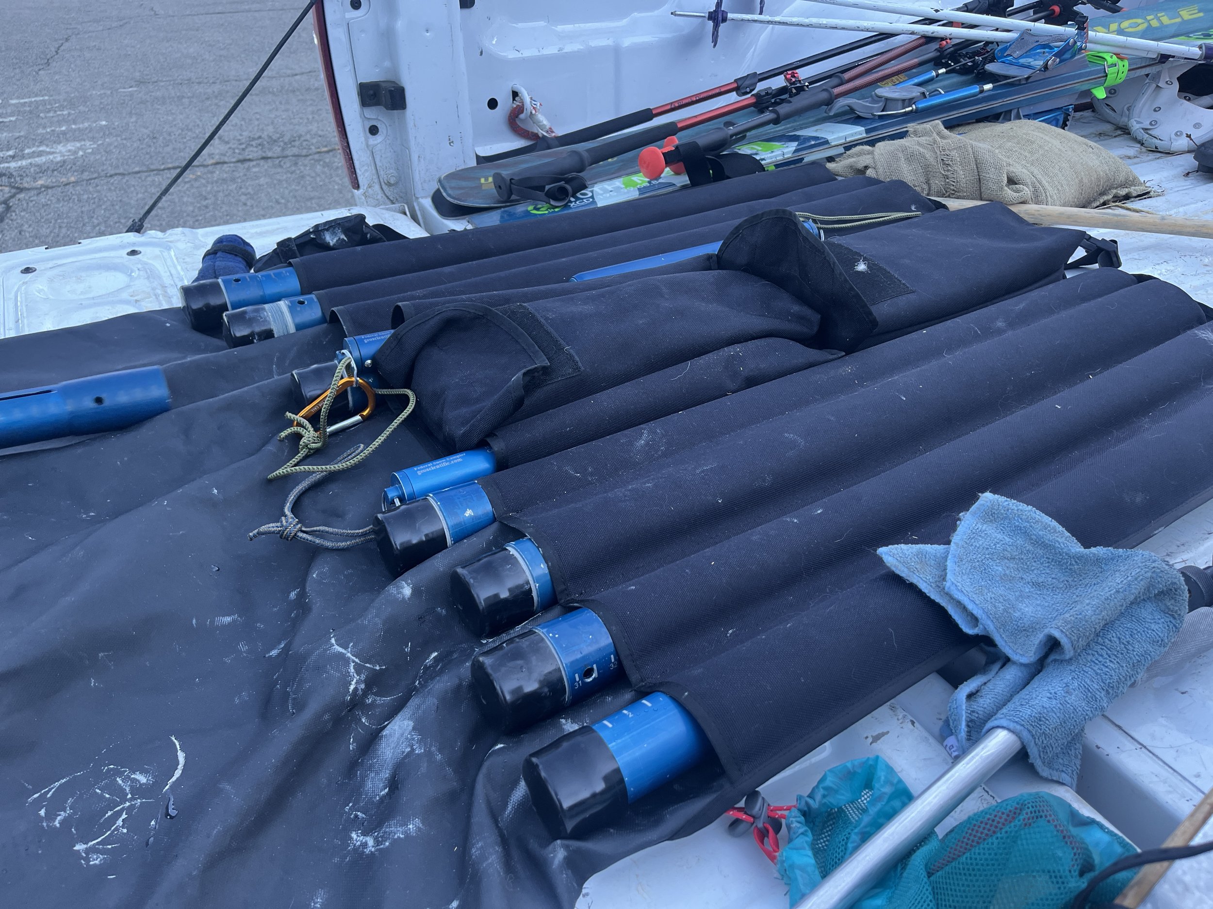
Established in 1929 by the California Legislature, the California Cooperative Snow Surveys (CCSS) program is a partnership of more than 50 state, federal, and private agencies. The cooperating agencies not only share a pool of expert staff but share in funding the program, which collects, analyzes and disseminates snow data from more than 265 snow courses and 130 snow sensors located throughout the Sierra Nevada and Shasta-Trinity mountains.
The reason for the survey is so that state officials can manage the state’s water resources for farmers, metropolitan communities, flood control, riparian habitats, and even flows for fish such as salmon and steelhead.

April 2023 Ostrander Lake Snow Surveyors
I was invited by my friend Chuck who is Yosemite’s Nordic Ranger and has been participating in snow surveys for almost twenty years. He is known as a Tube Master and it is his responsibility to use a snow tube at determined sample sites on a snow course to measure the snow pack depth and water equivalent.
At the Ostrander Lake Course we had over 15 feet of snow with an equivalent of nearly 80 inches of water. These numbers are calculated in the field by a scribe as we collect the snow samples, weight them, and move on to the next location using a tape measure for a precise location. Because the amount of snow, it was a tedious process of “multi” sampling or slamming the tube multiple times just to reach the ground. All of this data is submitted to the California Data Exchange Center in Sacramento for state water managers.

Snow Survey April 2023 Ostrander Lake
The Ostrander Lake Course requires skiing nine miles, carrying the sampling equipment along with your overnight gear. Since the majority of Yosemite National Park is designated wilderness, helicopters are rarely used to transport survey crews to the survey sites and human power is preferred.
Sampling Tube
What this means for fishing is that we will have water throughout the summer and into the fall which trout need desperately. Let’s hope that the bug life flourishes too because insects need water just as much as trout and of course trout eat the bugs. Caddisflies, mayflies, stoneflies all depend on moving, oxygenated, cool water for survival.
What this also means is that the rivers will be high, flowing fast, cold, and dangerous. Every season when Yosemite experiences higher flows, people die. In my ranger days visitors have gone over waterfalls, fallen into cold water (doesn't have to be turbulent), and have gotten hypothermia and drowned.
The local Native Americans have a story of their water spirit Pohono, which they’d share with their children to keep them away from water, because Pohono will take you if you get to close.
Don’t let this happen to you. Stay behind railings at the top of waterfalls for your safety, stay on trail, don’t scramble on boulders near the base of Yosemite Falls, etc. I’ve seen all these things happen in my tenure and it’s sad, but preventable.
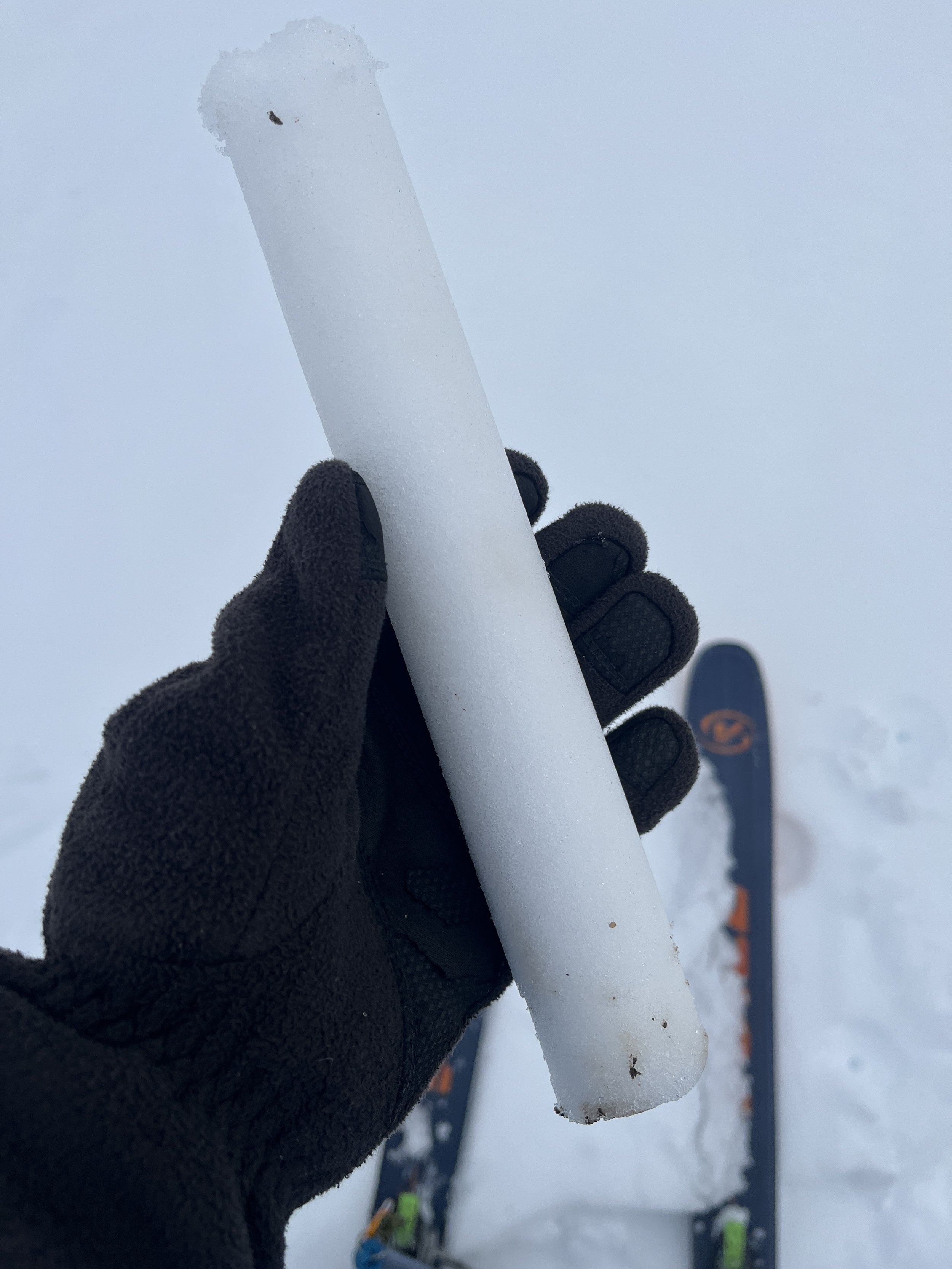
Snow Sample